

A Map of Hartford, Before the Interstate Highways
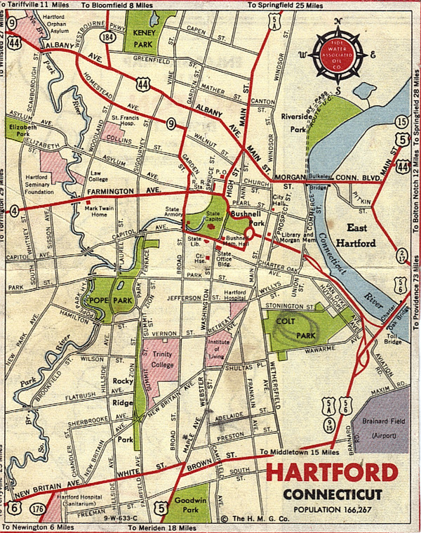
Here's a city map that appears to have been printed in the 1940s or early 1950s. View it at full size here.
The map carries no date, but there are enough clues to set a range. It could not have been printed earlier than 1940, since the city population shown—166,267—exactly matches the total from the 1940 census. The other end of the range must be 1955, for at least two reasons: 1) Aviation Road, in the southeast corner of the city, was renamed Reserve Road in early 1956, and 2) there's a pencil mark on Adelaide Street, in the South End. The map comes from my mother's family, which lived there until 1955.-KF
A note on the Tidewater Associated Oil Co. It was created in 1936 through a merger of the Tidewater and Associated oil companies. On the East Coast, including Connecticut, the company operated Tydol gas stations. (Here's what an East Hartford one looked like.)
References
"Population Is 350 Above First Report," Hartford Courant, July 16, 1940, page 4.
"Population of Connecticut Towns 1900-1960," Connecticut State Register and Manual, published by the Connecticut Secretary of the State.
"About the 1940 Census," National Archives and Records Administration.
"A History of Hartford Streets," by F. Perry Close, published in 1969 by the Connecticut Historical Society.


